![]()
![]()
Leader: John Hutchison Camp Administrator, Chris Bagley
Officers: Duncan Davidson, Lawrence Hall, Roger Hancock, Alan Sagar, Gerald Smith.
Boys: Nick Aleck, Peter Amos, Kevin Blake, Bruce Bomphrey, Jamie Bomphrey, Ben Buxton, Nick Caplin, Malcolm Clayton, Malcolm Cobb, John Courtman, Ian Darlington, Mark Davis, Hans Dobson, Kevin Puller, Andy Hayes, Chris Jeffries, Quentin King, Garry Longden, Dermot McRoberts, Philip Parsons, Graham Reeder, Huw Reynolds, Edward Rose, Glyn Savage, Nick Smith, Mark Taylor, Mike Thirkettle, Patrick Thompson, David Trevena, Clive Tucker.
|
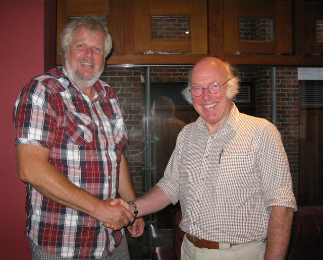
I managed to contact John Hutchison by e-mail, - I found him via a Google search as Chairman of the John Muir Trust http://www.jmt.org/about-the-john-muir-trust.asp . Although he still lives in the highlands of Scotland, it turned out that his daughter lives in Kent, not more than 50 miles from me. After a few exchanges of e-mail we agreed that next time he was visiting his daughter we would meet up. Well that meeting took place on Saturday 31st August 2013. This was the first time I'd have seen John in almost exactly 39 years. It was great to see him and it seems incredible but I still remembered him - yes we've both gone grey and John had lost a little more hair, but he was still the same guy I knew from 1974. I'd worked out, prior to our meeting, that I was due to start my first full time employment at Pfizer on my return from that trip to the Hebrides, so I'd probably turned 16 during the Harris 1974 trip. So- since I'd last seen John, I'd started and finished a career as a research scientist, got married, had three children, now grown up and retired (albeit very early - that's me retired, not the children!). Ah - the power of the internet! |
 |
|
John Hutchison and I meeting after 39 years. |
|
| I was approached to write 3 articles for 'Back in the Day' which is a monthly newspaper for the Outer Isles, one for each of my expeditions to N and S Uist and Harris this is how it appeared in the paper. Click the link. | Back in the Day Harris 1974 |
Unfortunately I haven't managed to track down any of my own photos from this trip, I do however have a couple from Ben Buxton who I managed to contact a couple? of years ago. I have also used a few from this site http://www.geograph.org.uk/ which has just about got the UK covered now so there are invariably one or two relevant pictures to be found.
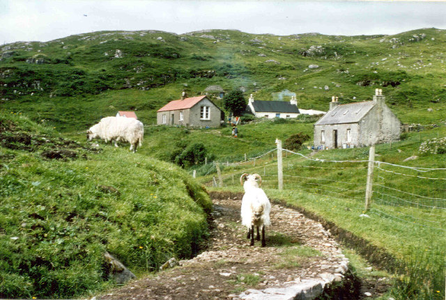
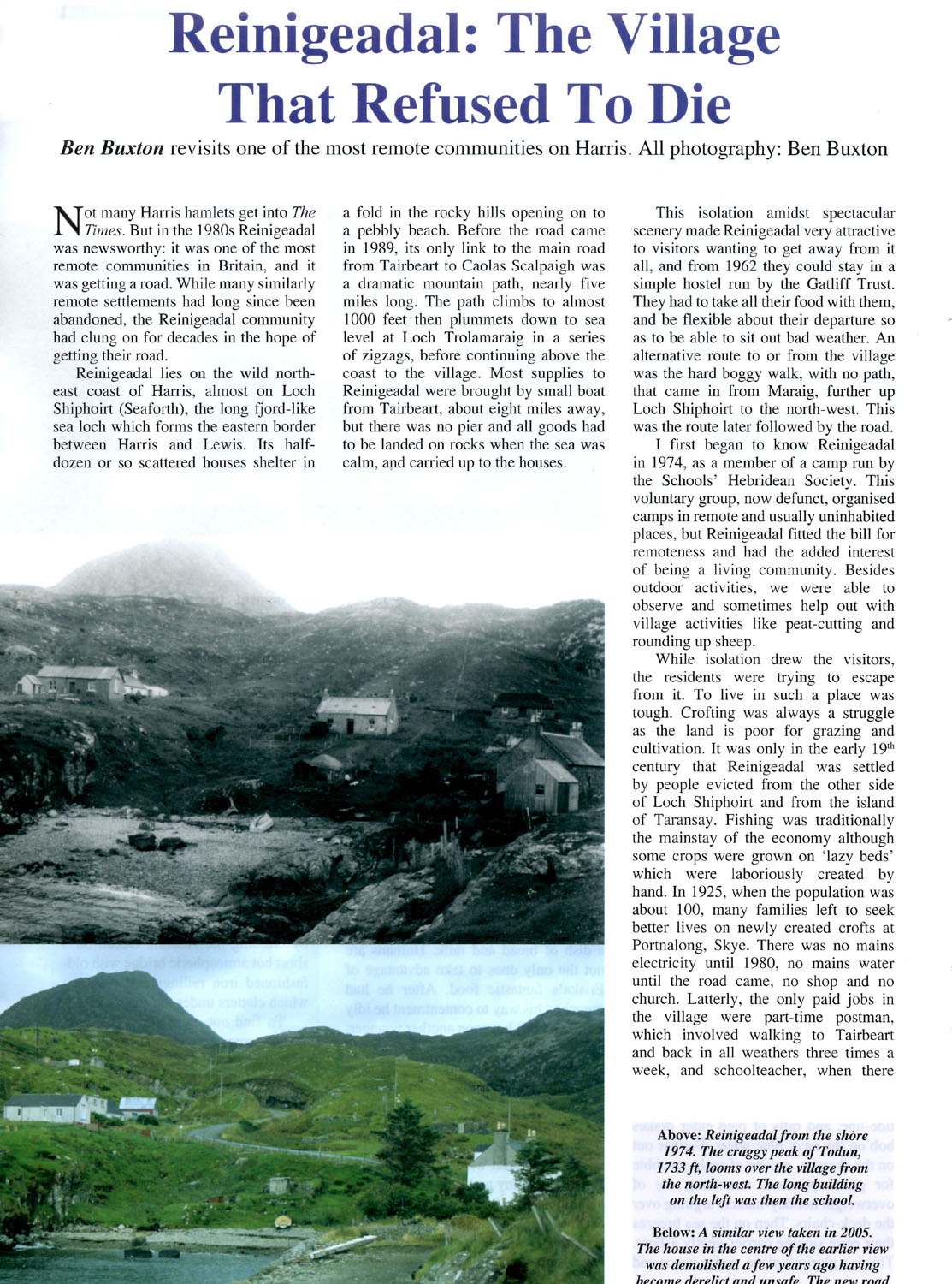
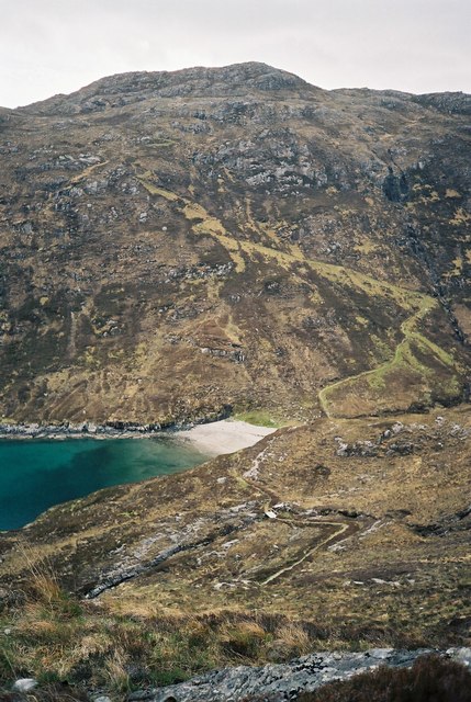
| The township of Rhenigidale as it was then and Reinigeadal as it appears now, was for a long time considered to be the most isolated community in the UK. There was no road leading to it, only a track/path that connected it to the road and on to the main town of Tarbert (now An Tairbeart, but I will stick with the old names from now on, as that is how most of us will remember them - if the new name is unrecognisable from the old I'll include it so that it can be found on a map). Although this trip to Harris was, of the five I went on, the most 'incident' prone, so there are lots of powerful memories, the walk from Rhenigidale to Tarbert sticks in my mind. From the hamlet the path climbed over a small hill and was for the first 2 km about what you'd expect for a path across a Hebridean island, climbing and falling ~50 metres, but then, when at sea level by the shore of Loch Trolamaraig the path zigzags up a very steep side of Trolamul. It climbs approximately 260 metres (850 ft) in a very short distance before dropping away towards the road. Now for a soft southerner like myself, the first time I did this walk (a total of ~8.5km or ~5.25 miles each way) it nearly killed me! Having said that, after a few days of walking everywhere and generally getting fitter, by the end of the trip the walk wasn't too bad. It would have been some time before I'd developed the level of fitness possessed by the postman/woman who did the walk daily (I've read daily and also 3 times weekly, either way, quite an achievement) * to collect and deliver the post. The community now has a road which will have done wonders for them and ease their life greatly, but I shall remember it for the killer walk. (The S.H.S can be proud of its link with the village as, were it not for the preliminary survey carried out by some of the boys on our expedition and our Leader's report for the Highlands and Islands Development Board, the road might never have been built. Comhairle nan Eilean Siar built the road in the 1980's on our line from Màraig, using John's drawing as the Location Plan!) |
* I've recently (02/11/2012) had information from John
Hutchison, he told me the postman was Duncan MacInnes and he actually did
the walk 4 times a week, in modern parlance - 'respect'!
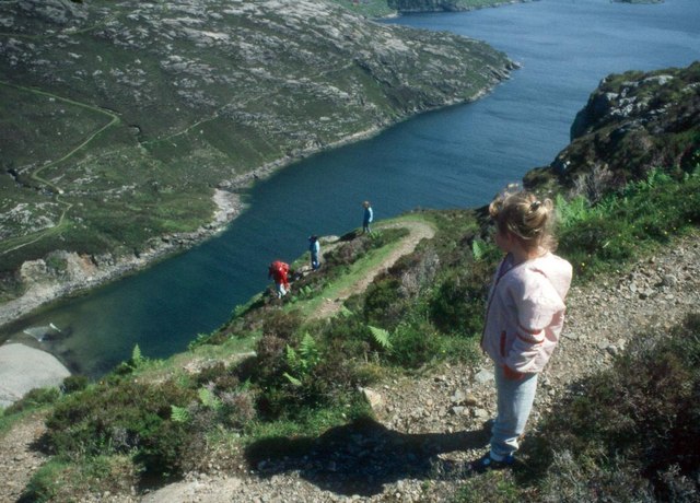
Left © Copyright Alan Reid, and Right © Copyright Calum McRoberts both from Geograph. The steep path from the shores of Trolamaraig (looking back towards Rhenigidale)
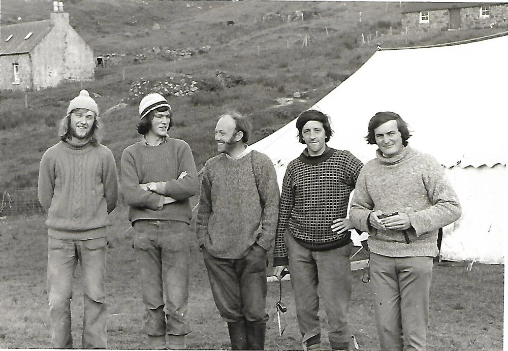
From the expedition
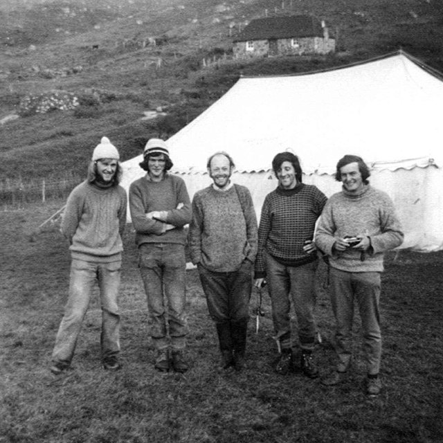
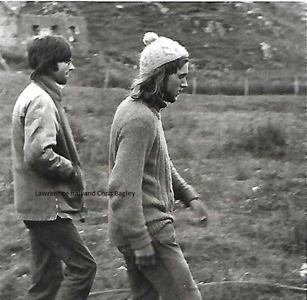
Left to right: Lawrence Hall, Roger Hancock, John Hutchison, Duncan Davidson, Alan Sagar
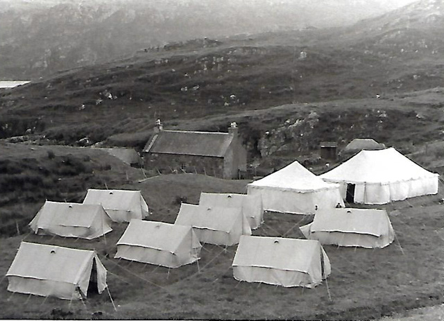
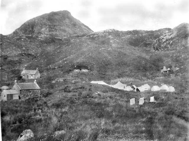
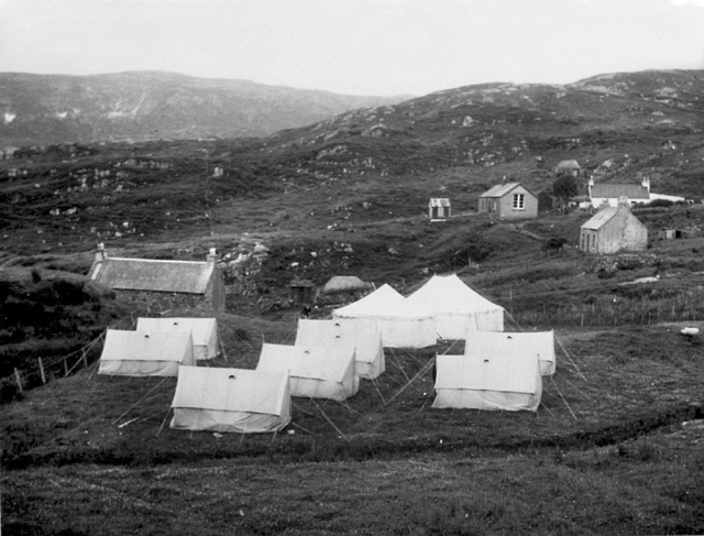
Right- Campsite with Todun (528m) behind |
 |
After all the preparation and planning what a relief to get away to Rhenigidale! Two thirds of the boys had been to Jura the previous year, but this venture was such a contrast. Firstly this was in the ruggedness of the area, and second in that we were living in a township of about 12 people. Rhenigidale situated on the mouth of Loch Seaforth has been visited by the SHS on three previous occasions, and yet we managed to find new facets of the area. We are indebted to the kindness of the villagers.
Despite assurances given by Patrick and myself that the weather which we experienced at the beginning could only be described as 'showers' the southern diaries recorded heavy rain, storms etc…! This and Duncan's late arrival marred the first few days, but even so we were established fairly quickly.
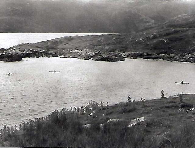
Much of our time involved water. We fished in it, canoed on it, tried to measure its range and currents, looked at its plants, and dinghy pottered on it. The landlubbers looked at birds, flowers, buildings, animals, sand dunes, and a line for a new road. Most of us walked a great deal to visit such places as Molinginish, Scalpay, Luskentyre, and for those who found the break from town life too much to bear, Tarbert.
Modestly the expedition must claim its records. Because of the absence of drift wood we became the first expedition to take its own furniture material, and after the installation of the 'Trans Rhenigidale Pipeline’ (1200 ft) the first expedition with water on tap in the marquee. Lawrence's personal feat must be recorded, viz replacing the previous record to Tarbert of 1 hr 17 mins by one of 55 mins, and an astounding 1 hr 51 mins for a jaunt from the marquee to Tarbert pier and back.
Our projects enjoyed varying degrees of success. Biology and botany were slow off the ground because of Duncan's late arrival but flourished afterwards. Our work at Luskentyre sand dunes for the Nature Conservancy Council received a setback when, on returning home, we found the film had not been exposed and we had nothing to show for the visit. Our study of a possible route for a road to Rhenigidale was successful and a report has been sent to the Highlands and Islands Development Board.
We will remember the happy times; the great evening Ceilidhs and the party for the villagers on the last night; the football tournament when the Leader's undoubted Goal was disallowed; the Sunday service when we sang 'The Lord's my Shepherd' to the tune of 'Amazing Grace', and how Mrs MacInnes was moved by this old Gaelic psalm tune; the 'tents' bivvy and Lawrence's bread consumption. We will remember the times which we thought were sad or difficult but on reflection were times of unity; striking camp in such rough weather; the bus accident on Skye and Alan's prompt actions; on a wild night carrying a villager, Angus Campbell, to the boat en-route for Stornoway hospital; Gary's suspected appendicitis and Gerald's accident with the irony of its circumstances. Gerald is fit again, and his main concern being the sudden end to his expedition. Thanks to everyone who helped at those times.
We each cherish our memories knowing we have benefited from our experience, returning home with a better understanding 13 of other people and ourselves. By living in the township we learned of the difficulties of life there. Most people helped by laying the pipeline to the hostel, digging for the septic tank, demolishing the old building which will form a new byre, and cutting and drying peat. We hope that we have partly repaid the villager's patience with these things.
Thanks are due to so many people. To Sir Hereward Wake and Roddy MacInnes for permission to use the site; to my wife for her tolerance, to the splendid group of officers whose ability and energy made my job easier, and to the boys whose enthusiasm made everything worthwhile.
Lastly thanks to the villagers of Rhenigidale. " Moran taing airson bhur coibhneas agus tha dochas agam air faicinn o choinn ghoraidl"
JOHN HUTCHISON
© Copyright Ian Mitchell
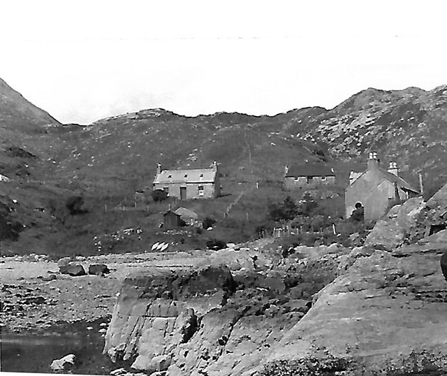
Left is a view of Rhenigidale taken in 1976 and right the photo from Ben Buxton taken in 1974 of our campsite.
The incidents that I referred to above are also covered in the report by John Hutchison, but again time has morphed the events somewhat. I remember the coach accident on Skye, (I can even still see in my 'minds eye' the amber indicator cover smashing against the caravan as the coach overtook it fractions of a second before the caravan flipped and turned the car over), but if my memory is correct it wasn't our coach but one in front? If that is the case I'm surprised I could have seen the indicator cover getting broken? A group of us were sent to ask if anyone in the queue of cars had a hydraulic jack to try to lift the coach off the upturned car. It was probably a bit like a midwife getting the husband to boil water during a home delivery - keep them out of the way but give them something to do to make them feel useful! I have no idea how the situation was resolved in the end, how did we get past the accident to continue to Uig?
Gerald's rock climbing accident is another fuzzy memory. I know I was there, again a vivid memory of him falling back, being momentarily held by the rope and the piton (or equivalent) before that gave way and he fell the remaining distance, landing on what little bit of beach there was, with his head under the water. The bit that I'm not sure about is who was belaying the rope. For many years I thought it was me, I was stood underneath when the dislodged rock crashed down beside me followed a fraction of a second later by Gerald. But a few years ago I got in touch with Hans Dobson and during our conversation we related this story, but Hans thinks it was him feeding the rope for Gerald! Anyway after the few seconds of controlled panic, everyone rallied and put the emergency procedure into operation. I and someone else (should have been someone a bit fitter than me I think) headed off for the camp to get assistance, on our way we spotted a small fishing boats in Loch Seaforth, so we set of a couple of flares from the emergency kit. They didn't make it above the height of the intervening ridge from what I can remember, whether they were damp I don't know, but I doubt anyone other than us saw them. Fortunately Gerald made a full recovery once he'd got to hospital, but I know everyone was very concerned to hear how he was progressing.

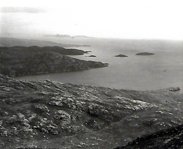
© Copyright Dr Julian Paren
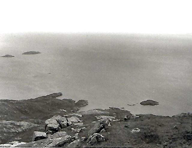
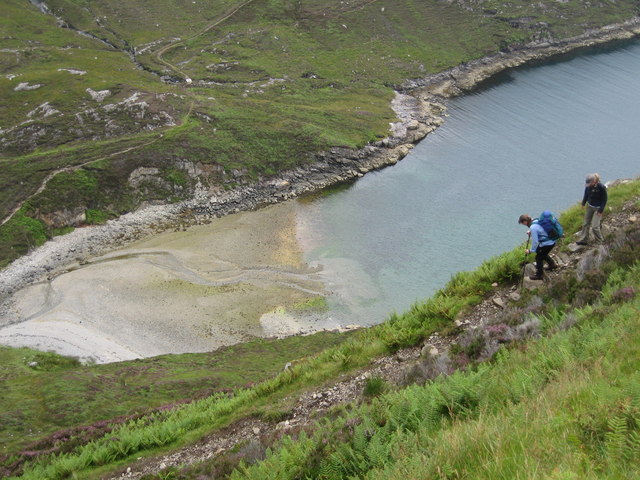
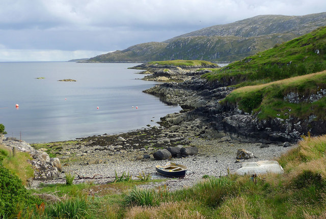
Looking inland from the headland, Rhenigidale is at the head of the loch with the mountain of Todun behind.(528m, 1732ft).
I'm fairly sure it was just off the little beach at the head of the loch that we used the inflatable dinghy daily to check our home made lobster/crab pots. I don't think we ever caught anything but it was a good excuse to potter around the bay in the dinghy.
One of the islanders took us out in his boat and showed us how they fished, with a set of feathers and no rod, and just an upward movement of the arm holding the line (basically jiggling the hooks up and down) and we'd caught more fish in an hour than I'd probably caught ever before (I was never very good at fishing!). In fairness, it was quite a good spot as there was no beach, the cliff rose directly from the deep water.
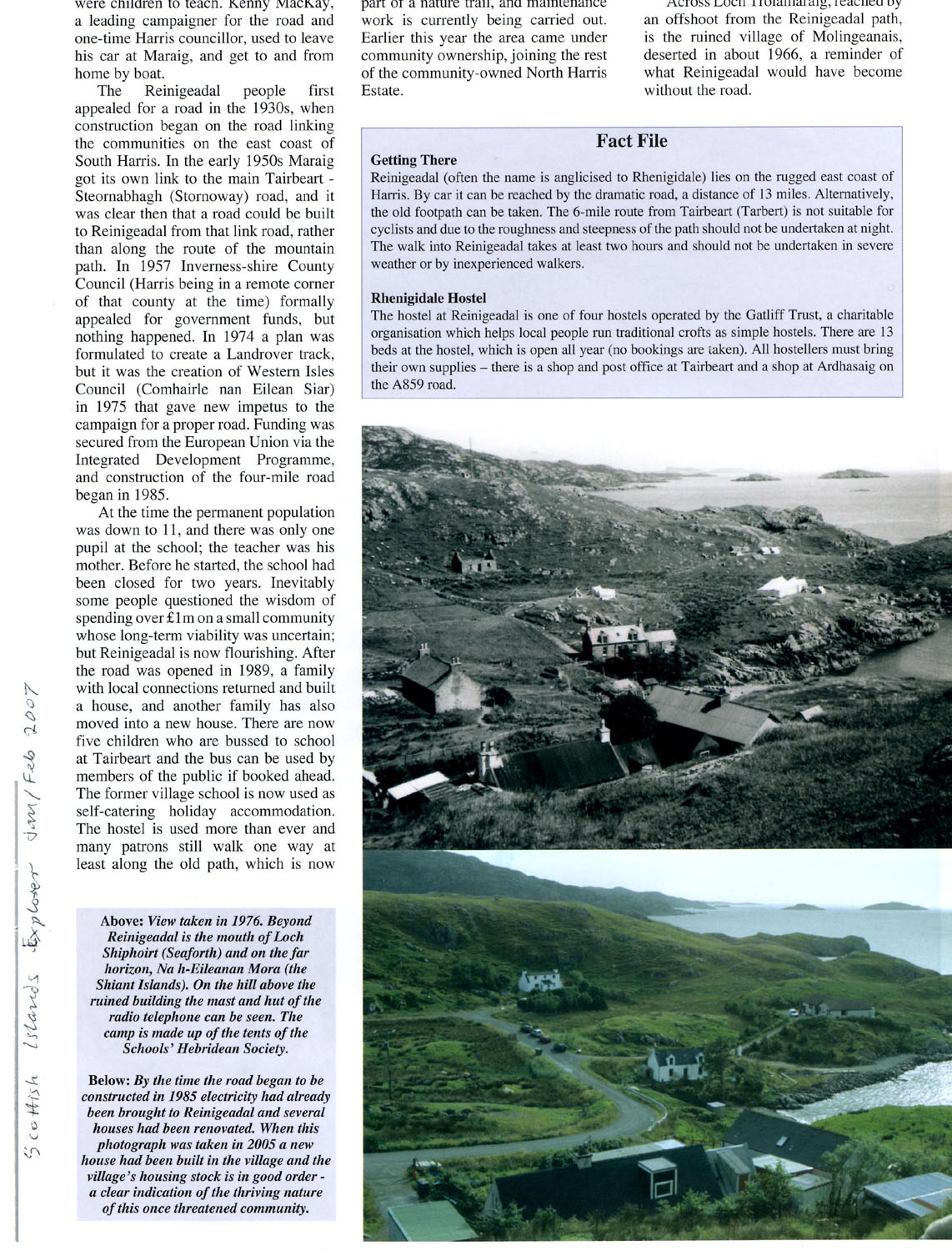
Below is a copy of an article written by Ben Buxton in 2007 about the new road coming to Reinigeadal.
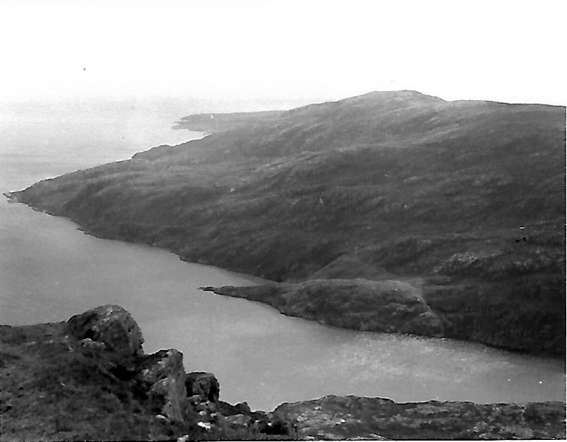
Two more views, Rhenigidale and nearby, above (© Copyright Dr Julian Paren) the beach and left, the path to
Tarbert where it zigzags up the hillside. (© Copyright Catherine Morgan)
As for the comment in John Hutchison's report regarding the late arrival of Duncan Davidson, I wasn't sure if I knew at the time where he was or why he was late but when I returned home after the trip, my parents had kept an article from the newspaper about him. He had gone across to one of the smaller uninhabited islands [Mingulay I think] prior to the Harris expedition, it had required transport in a boat from one of the islanders on the nearby inhabited isle. For some reason, possibly weather related or absentmindedness the said islander didn't pick Duncan up on the appointed day, nor for some days after, forcing Duncan and his co-castaways to fend for themselves and find food where they could, shellfish, rabbits etc (there was no mention of eating a sheep but it must have been tempting!)
SEE HARRIS 1976 from the expeditions page for a contribution including some photos by Ian Mitchell, not an SHS member himself but he was at Rhenigidale hostel at the same time as that trip and they were invited to the farewell party.
Since starting this web site, reading the
reports, seeing photos etc, I have had many memories sparked, one such has just
come back to me. I thought I remembered a concrete boat abandoned in the bay on
Scalpay, a small island just to the south east of Tarbert. I've since seen
concrete boats and barges but at the time it struck me as very odd. I just
looked on the Geograph site and sure
enough, there is a photo of a concrete boat (thus proving how durable it could
be!) about where I thought it should be. However, the photo, shown below isn't
quite how I remember it, in my mind it was a squarish, almost landing craft
shape whereas this appears to be a concreted traditional boat, maybe it is a
replacement for the one I think I saw?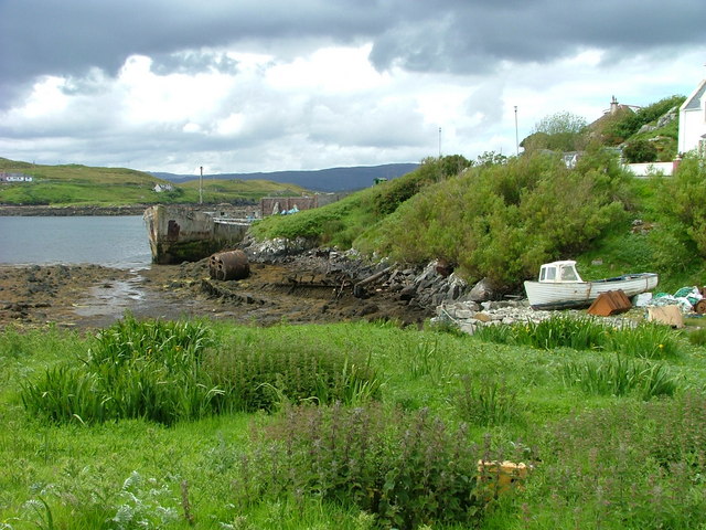
© Copyright Dave Fergusson
Reading the comment associated with the photo it would appear this is the original!
"Appropriately named 'Crete Tree' the boat was a coal hulk anchored in Glumaig Bay in Stornoway for
many years. The Scalpay Shipping Co. Roderick Cunningham (Scalpay) Ltd towed her the 24 miles
to Scalpay and scuttled her to form a pier of sorts in 1962"
This then prompted another memory,
walking around Scalpay, many of the ditches and roadside verges had empty 'Tennents'
lager tins scattered in them, I don't think this was necessarily exclusive to
Scalpay by the way. Two things come to mind, firstly, didn't the tins have a
photo of a girl on them, not just one woman, but a range of models? Well, as the
photo below will testify, that is correct, these are tins from the early 70's.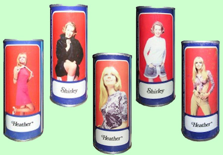
The second memory was someone asking a local man if there were anywhere on Scalpay where you could purchase a beer? "Nay lad, the island is dry". Well perhaps someone had drunk it all and chucked the cans in the ditch?
I see that Scalpay now has a bridge, when we were there it was a little ferry operating across the 600m channel. Until I'd seen the photo of the bridge I'd not considered how we crossed to the island but then I remembered the little ferry. Again, I'm not sure if this was a bivvy, I assume it must have been as it is probably 8 miles from Rheningadale plus the 1000 foot climb out of the village, I'm not sure I completed the round trip in a day.
And finally - for now at least, Scalpay harbour, another unconsidered question of a local man, "Is there much fishing here?" The reply was suitably succinct, with a shake of the head the man replied "Can you nae see the bloody fleet lad?" - sure enough, just behind us were tied up against the quay a selection of small fishing vessels. I notice from modern photos they are not there now unfortunately.
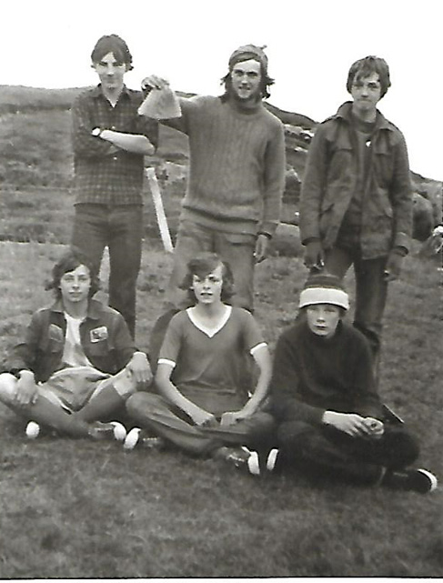
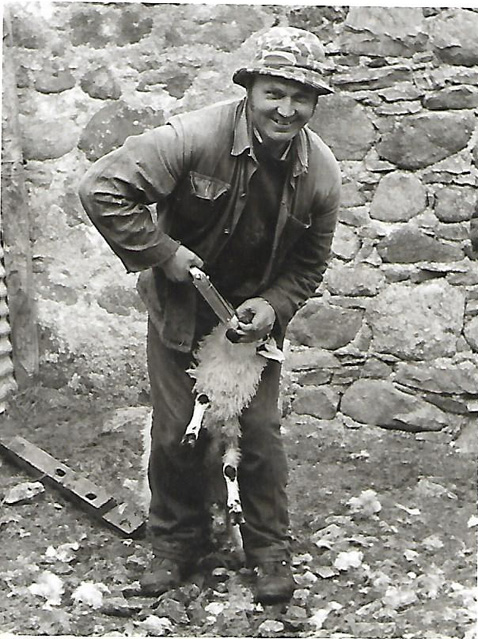
I recently contacted John Courtman and he forwarded the following photos, - the first two are after what I think must have been our fishing trip with the Rhenigidale local mentioned above. The third photo may have been our bivvy - perhaps on Scalpay?
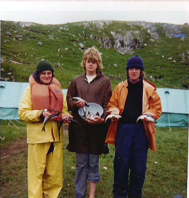 Alan Sagar, Nick Smith and John Courtman with our catch. |
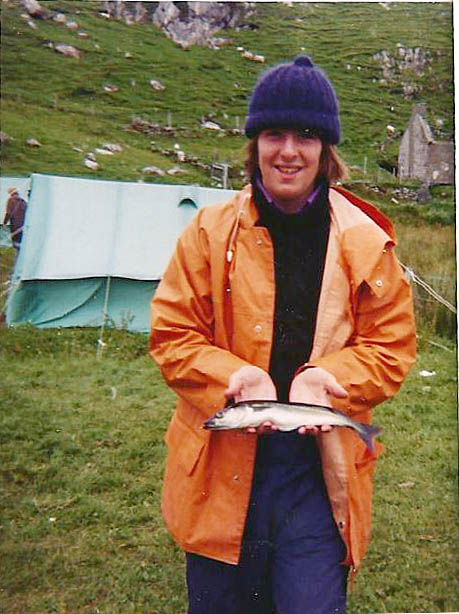 John Courtman with what looks like the winning fish! |
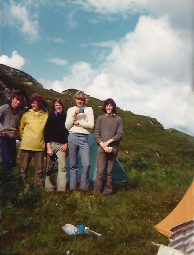 ??, Mike Thirkettle, John Courtman, Nick Smith and Roger Hancock |
|
Again, my thanks to Ben Buxton who supplied the following - The first circular from John Hutchison for the Harris '74 trip and additional info about the officers. HARRIS EXPEDITION 1974 (l) This sheet is intended to serve as information to introduce the area and to act as a basis from which to start your own thoughts* The area of the site is typical of Harris scenery; very barren but beautiful. The rock is generally Archean Gneiss, a granular, grey rock with lines of granite and other intrusions and is overlain with peat of varying depth. The overall land picture is dry, contrasting with the bogs and innumerable lochs of Lewis and North Uist. Because of this, it will be relatively easy to get around, the only restriction en our movements being that we must keep to the East of Tarbert - Stornoway road, except to climb Clisham. The site itself is about 7 miles ENE of Tarbert, at the mouth of Loch Seaforth (O.S. 1" sheet 18 228018). We will be living in the midst of Rhenigidale, a community of about 14 persons whose normal routes of communication with the rest of the island are by sea or by a 5 mile track to the Tarbert -Kyles Scalpay road. The fundamental difference between this and the other sites which we have used is that we will actually be living in the community, although one should not imagine that this will make the site seem any less isolated. We will appreciate the remoteness even more as the various problems of living in such a location will be readily apparent. What is important is that we are venturing into the township and must be as unobtrusive as possible, At the moment the dates of the expedition are 22nd July - 8th August, these being ex-London and may vary on inspection of time tables. The route is likely to be London - Edinburgh - Inverness - Kyle of Lochalsh - Uig (Skye) -Tarbert and thence by bus and a 5 mile track to the site. We are likely to be about 38 in number and will be camping in sections of 5 or 6, each section taking turns in cooking duties, etc. We will have the use of a house in the event of very bad weather. To my mind, we have two aims for the expedition. Firstly, enjoyment and second satisfaction. The first is about building an existence for ourselves and enjoying the experience and company which an interdependent group gives. The second is about using the unique opportunity of such a location to best advantage. The possible activities and projects depend upon our own abilities and interests but satisfaction comes from having been involved as deeply as possible. I hope that we will all give activities and projects equal energy. To make full use of our opportunities we should produce flexible plans in advance so that little time will be wasted when we reach the site. Perhaps you can make the expedition more fruitful for yourself if you can use it to undertake some 'O’ or 'A’ Level project or complete the expedition part of the Duke of Edinburgh Award Scheme ? At the moment I have two projects which we can do for outside parties but I will be detailing these later. Rather than list information about the area, I mention some books which you might find worthwhile as background reading. You will probably want to write with queries about the site and its possibilities for your particular interests; I have been to the area twice previously and so should be able to help! I intend to send out the next circular around April or May and, in the meantime, I look forward to hearing from you all, John Hutchison
Only certain parts of the books in the first group are relevant whereas the second forms a light introduction to the way of life in the Islands. PS. I have just confirmed two interesting projects with the Highlands and Islands Development Board and the Nature Conservancy Council:- Access Track to Rhenigidale (HIDB) This project involves the survey of a possible route for a Land Rover track to the village in as nuch detail as we can reasonably do in the tine. This has been sought by the township for at least 40 years and this could be a valuable start. Survey of Dunes and Machair at Luskentyre (NCC) This would form the base from which to check future erosion and movement patterns and would be of interest to our geographers and conservationists. These authorities are willing to pay expenses in hiring equipment for the jobs and in order to justify this I must know if you are interested in doing either of these projects for all or part of the time. The Society has wanted to do some valuable project work for a number of years and this is a real opportunity! Could you please let me have your views on this as soon as possible?
Appendix;
Officers/Interests/Projects: The officers are versatile and have fairly diverse interests - as you will see; To introduce them and their plans for the trip Duncan Davidson; Is an experienced SHS man having been on 3 previous expeditions and will be Deputy Leader. Interested in natural sciences, art, music, poetry, etc. - on the expedition will be doing a study of botany or the sea shore. Duncan plays the tin whistle, sings, and is currently doing a Ph.D. at Edinburgh University. Chris Bagley: Is our Camp Administrator - has interests many and varied but on the trip will be concentrating on ornithology, photography, and possibly canoeing. Chris is a school teacher at Poole, his main subjects being Maths, Computer Science, and Physics. Alan Sagar Will be our Doctor. He hopes to pursue his interests in natural history, painting, sketching and ornithology. Alan has considerable experience of farming and is a Medical Student at Leeds University. Gerald Smith: Will be on the advance party. On the trip he will be doing hill walking, orienteering, meteorology and perhaps cross-country running. Gerald plays guitar and mouth organ and is about to begin a Forestry course at the University of North Wales Roger Hancock: Interested in hill walking, fishing and fauna, and hopes to follow these on the expedition. Roger plays guitar and the bagpipe and, after teaching for a year in Stevenage, is about to begin a Vet. course in Cambridge, Lawrence Hall; Part of the advance party. Hopes to do ornithology, hill walking athletics, settlement on the expedition. Lawrence sings and plays the guitar and is about to begin a University course in Physics. Ian Gouqh; Has been on two previous expeditions and may follow up his previous work on mosses - also involved in boating and canoeing. Is a student at Oxford University. John Hutchison; Three previous expeditions, one to Rhenigidale. Interested in music, history, and Gaelic. Intends to do road project and survey of dunes at Luskentyre. Sings, plays tin whistle, mouth organ and guitar (all badly!). A Civil Engineer currently working in Skye.
Fishing; A fishing project is developing; Roger hopes to check for the presence of Char (genus Salvelinus) in the lochs to the north of the site. The Nature Conservancy have asked us to do this in various sites as one variety of this fish is a "relic" of the Ice Age with a sparse distribution in the North of Scotland. These fish apparently go for a worm on the bottom, a -½” golden spoon or a trout fly at night — be prepared! Road Project; This is quite ambitious and we may have only limited success. I hope to do an outline survey of a proposed line and eventually to assess the amount of work and likely cost of such a project. Dune Survey, Luskentyre; If time and weather permit we may be able to survey a narrow strip fron the road to the shore to record the present position of the dunes - we might use photography for this also. |
| 20/08/2017. I am delighted to find people are still discovering this website and e-mailing me, I have just received this from Gary Longden who was on the same trip as me to Harris, great to get these personal insights for the site, thank you Gary. |
|
I thought you might be interested in this: What a delight it was for my friend, Peter Kerr, to introduce me to the website commemorating the Schools Hebridean Society whom I joined for their 1974 trip to Rhenigidale, on Harris, in the Outer Hebrides. It brought back many memories, I am pleased to say that most were readily recalled, but much useful supporting information was less well remembered, and gratefully read. My recollections are as follows: I agreed to go without giving it much thought. My father was in the RAF, and one of my friends Mike Thirkettle, whose father was also an RAF officer, was going, and it seemed as good a way as any to spend the summer after having sat my “O” levels. I was not an experienced walker, or camper. The furthest north I had ever been was Leeds. I did no background research. Pre-internet, there would not have been much anyway. So I turned up at London Euston station for the overnight train to Inverness as unprepared, apart from the helpful checklist items supplied by the SHS, as it was possible to be for the 8.30pm departure. Although I assume that some Society Officers were present, they were not visible, so we boarded our train, said farewell to parents who were probably grateful to be losing their sixteen year olds for a fortnight, and settled down for the ride. They were the old fashioned carriages with an side aisle thoroughfare off which cabins of six were accessed by sliding doors. Mike and I chose one, and soon found friendly company in the other four who joined us in the reserved accommodation. Before long we were introducing ourselves to the other SHS reserved compartments, it was a good crowd. The first few hours of our journey were spent consuming as many Woodbine and No6 cigarettes as it was humanly possible to smoke, and to drink dry the Tartan Ale (in anticipation of our Scottish destination obviously) and Watney’s that we had brought for the journey. It was to be a long journey, and it soon became apparent that sleep in a full carriage of six was not going to be easy. So, displaying a resourcefulness which had no doubt been a pivotal quality in the selection process, two boys slept on the luggage rack, two on the facing seats, and two on the floor. I am not saying that it was comfortable… I recall us stopping at Preston, and wondering what on earth was the point on an already full train, but yes overcrowding and sleeping in corridors was a feature of British Rail back then too. You just pay more for the experience now. Glasgow station in the small hours was as desolate, and god forsaken a place, as it is possible to imagine. Imagine a post disaster Chernobyl, then wind your expectations down a little. For the first time , my excitement about the trip began to dip. Around 3am, the train was approaching the Highlands, and as dawn broke the magnificence of the scenery was brutally apparent, dominating the rest of the journey until we arrived in the Granite City some twelve hours, and 560 miles, later. Inverness by morning was considerably more attractive than Glasgow at night, but we didn’t have time to explore as we caught our connection to Kyle Lochalsh, a much shorter 63 miles along a single line. There, we caught our coach, and the short ferry to Kyleakin (a ferry journey sadly no more, made redundant by the Skye bridge). By now, the thirty boys, and officers who had joined us along the way had started to become acquainted. About two thirds had been before, but all were up for an adventure, and it was not long before the drama started. I have read two other accounts of the road traffic accident we encountered, mine, if my memory serves me correctly, may add to them I noticed the coach in front of us attempting to overtake a slow -moving car towing a caravan, the coach pulled in t0o early, all vehicles lost control, and the car ended up, upside down, under the coach. A Dutch couple, who spoke good English, and a child were in the damaged, and worryingly creaking overturned car. Understandably they were worried about being crushed under the coach, but were trapped. We were worried about rescuers being crushed attempting to extract them. Fortunately in our leader John Hutchinson, and Medical Student Alan Sagar ( his training may not have reached the bit about car crash trauma at that point), we had two men ready to rise to the moment. With no passing traffic, and some twenty five years before mobile phones, we were, in the wilds of Skye, on our own. Thirty boys were lined up, hands under the chassis of the coach sitting on top of the car, and on the count of three we flipped the coach off with an ease which would have surprised Superman. It certainly surprised us. In truth, it was an agonising call. Do nothing and the weight of the coach could have crushed the injured couple and child. Enter the car to try to extract the injured, and more injury could have been caused by the extraction, and the rescuers could have been crushed along with the occupants. Try to flip the coach and fail, the coach would crash back and the occupants could be crushed. Flip the coach in one, and the danger would be over and a safe rescue executed. They made the right call. Fortunately, the remainder of the fifty mile trip was uneventful as we stopped off at Portree at the Portree Hotel for the night before heading on to sail from Uig to Tarbert the following morning. I remember well the mental financial calculation the landlord made when weighing up the risks of serving what were clearly thirty under age boys alcohol, versus the financial benefits. Money won. The ferry journey itself was an introduction to what was to come. It was wet, it was windy, the sea was rough, it was August. Fortunately, I had assimilated good advice about rough sea crossings. Go below deck so you cannot see the horizon, and find a seat in the middle of the boat where the roll is minimised. It worked, as many of my companions succumbed to sea sickness on deck, I was quite happy resting up below, for the journey of just under two hours. Tarbert was small, dour, and non-descript. It was also the last piece of significant habitation we would see for some ten days. The coach stopped abruptly on the Tarbert to Scalpay road for no apparent reason. As we decanted, the reason became clear. A rough track, five and a quarter miles, a zig zag path, and a descent of around 1000 feet. An advanced party had taken our camping equipment by sea, but we were still quite heavily laden carrying all of our personal possessions needed for a fortnight plus some additional group supplies. It was our first test. We were there. Shelter was over five miles away, the rain was coming in again, and the only way that was going to change was for us to crack on, which we did. We arrived at our campsite at Rhenigidale at teatime, almost two days of travel from when we departed London. The good news was that our sleeping tents, mess tents, and toilet tents were up, the bad news was that there was still plenty to do as our six man tents were rostered for all the tasks that are needed to keep almost forty people going. As soon as we were organised and had prepared our evening meal, we all retired for a very sound sleep. The following, rainy, morning we took in our surroundings. The most remote hamlet in Great Britain comprised a handful of stone cottages, fourteen people, no running water, no mains electricity, a track in, and egress via boat, with no jetty or pier, just rocks, if conditions allowed. John did an excellent job at fostering good relations with the locals, the boys generally busied themselves elsewhere. One of the pleasures of the stay was that although there was plenty going on, we were largely free to do what we wanted from the options available. Rules were at a minimum, self-discipline was essential. I went sea canoeing, having never set foot in a canoe before, in retrospect it was dangerous, at the time it was exciting and exhilarating, the brakes were your self- awareness that you had entered into a situation, and you had to be able to exit it. I fished, I helped John with the road survey, and now lay claim to my place in the building of the road which now makes everything so much more accessible and easier for everyone. We hiked miles and miles, almost always in rain. For some reason I didn’t climb Todun the 1733ft hill which dominates the village. I do recall on a hike traversing streams in spate, in rain, and taking lunch pressed against a rock face, barely sheltered by an overhang, which comprised dried date, and leek soup heated with a portable stove. At the time it was the most welcome meal I have ever had. But it was the second major incident of the trip which shook me the most. A group of us set off to do some abseiling down a cliff. The leader, mountaineer Gerald Smith, was the first to make the descent, but a piton came loose causing him to fall some dozens of feet to the rocky shore below. A few managed to make their way down to where he had fallen, but he was unconscious, on rocks. The situation was grave. The incoming tide meant that if we did nothing, he would drown. A rescue by inflatable was impossible because of the jagged rocks. His position at the foot of the cliffs, in wind and rain, meant a helicopter rescue could have been impossible. With tremendous resourcefulness, and courage, a party, including Alan the medic, took a wooden boat, with a villager, to rescue Gerald and take him to the headland where the air sea rescue helicopter could rescue him and take him to Glasgow. Fortunately, he made a full recovery. The third mini drama was my own. I was overcome with overwhelming stomach cramps which lasted all day and night, resulting in my boat journey to Tarbert to see the GP with suspected appendicitis. Fortunately, he banked on waiting to see if a concoction of gastric remedies would do the trick, before my also being flown out, these proved successful resulting in a much more pleasant boat trip back to camp. The summers evenings are long in the Western isles and most nights we had a Ceilidh, comprising traditional songs led by John Hutchison with his tin whistle, and contemporary, mainly Neil Young songs accompanied by Roger Hancock on acoustic guitar. There was, and is, something magical about a group of people making their own entertainment through song in the evenings. On the final night the villagers joined us, but mostly kept themselves to themselves, I vividly recall one of them coming across on a Sunday when we were playing football, and being told we were not allowed to play games on the Sabbath. It was with some bemusement that we reflected that we were in about the remotest populated place in the country – and there was someone stopping is play football… I remember nothing about the trip back to London. We were so wet, so tired, and so grateful to be returning to civilisation that everything else seemed to be shut out. As the above suggests, it was one of the most eventful trips of my life, memorable both positively, and negatively. Before the days of reality television, a group of strangers were thrown together for real, forged relationships, endured adversity and challenge, and made it through. The place made a lasting impression upon me, and I was lighted to return to Lewis, some forty years later, to reappraise the islands. It did not rain, the hotel was comfortable, the shops were well stocked ( though not always open when you might expect) and the people exceptionally friendly. The scenery was to die for. Thank you to the schools Hebridean Society for giving me the chance to visit in the first place, I hope that in the future, its noble aims might be resurrected for new generations." Gary Longden |
![]()
![]()
![]()